Slowly making our way down the steep trail from the ravine bowl.
HHS Seniors Attempt Tuckerman Ravine
Tuckerman Ravine: The holy grail of east coast backcountry skiing.
June 12, 2018
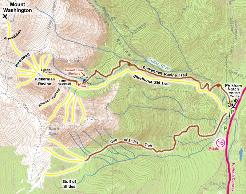
A map of the Mount Washington area to serve as a reference point as you read the rest of this article.
Over this past year’s April break, six Hopkinton High School seniors, including me, took a trip to the White Mountains in New Hampshire to take a stab at Tuckerman Ravine. Tuckerman Ravine is a bowl located on the southeast face of Mount Washington. It is considered the holy grail of east coast backcountry skiing because of its remote location and its sheer difficulty.
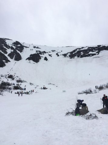
A shot of Tuckerman Ravine in April 2017.
In this article, I will outline what we did to plan our trek and then I will recount the events on the day of our hike. Breaking from convention, the most interesting part of this story is near the end, titled “The Hike,” but for clarity, I arranged the article in chronological order.
The trip fell into place because of the housing. Lu Wang, one of us six seniors, was able to book a condo months in advance because of timeshare points his mom had.
“It just so happened that right about the same time we were planning the trip, [my mom] realized she had a timeshare and the points were going to expire that same week, so I told her about the trip,” Wang said.
The idea of going to Tuckerman Ravine had floated among us friends for a couple of years, but it did not come together until this year when the housing was set in place.
“Some of the other guys and I had this idea a couple years ago, I think towards the end of sophomore year. We’ve always wanted to go to Tuckerman, we thought about it, and it never really came together until this year,” Wang said.
“Maybe two years ago Andrew [Smith] talked to me about going with one of my other friends, who is now at Syracuse, but we never did that,” Chris Pomeroy, one of us seniors, said.
To plan our trip, I used numerous resources including the Mount Washington Avalanche Center, Mount Washington Observatory, TimeForTuckerman forum, and the Friends of Tuckerman Ravine Facebook page.
Equipment
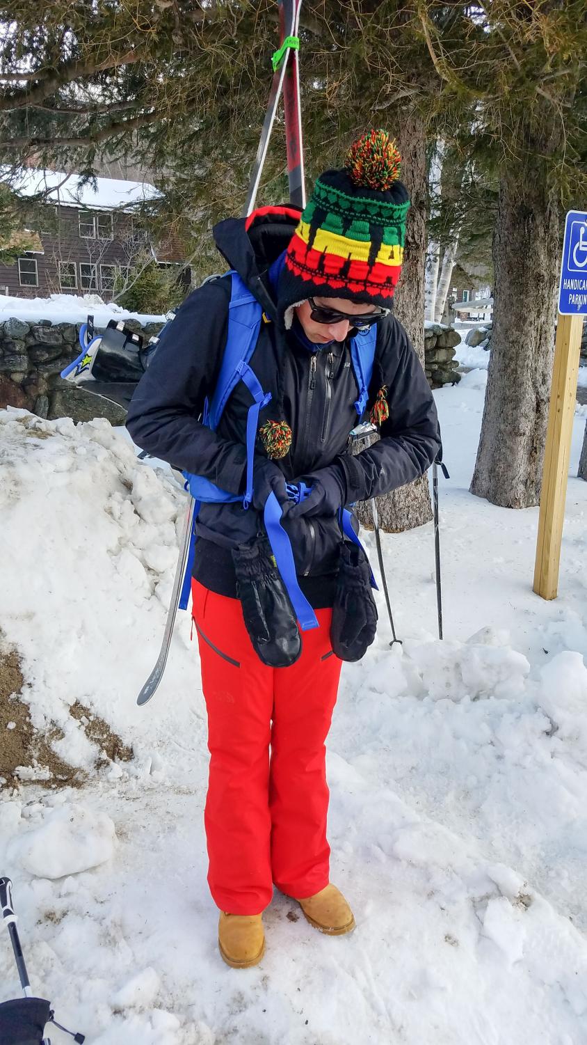
10:24 AM. Chris Pomeroy getting situated, strapping his brand new pack to his back in the parking lot of the Pinkham Notch Visitor Center.
Adam Antaki, my brother, did Tuckerman Ravine in late April of 2017. From the strong recommendation of him, I bought a proper ski carry, alpine backpack two weeks prior to the trip. My friends also acquired similar backpacks.
Wang said that he bought a backpack off of Amazon a week prior that could carry his snowboard. He also bought a pair of winter boots, but other than that he had everything else he needed.
My brother said that having a proper pack makes the hike much easier because everything is secure and not bouncing around.
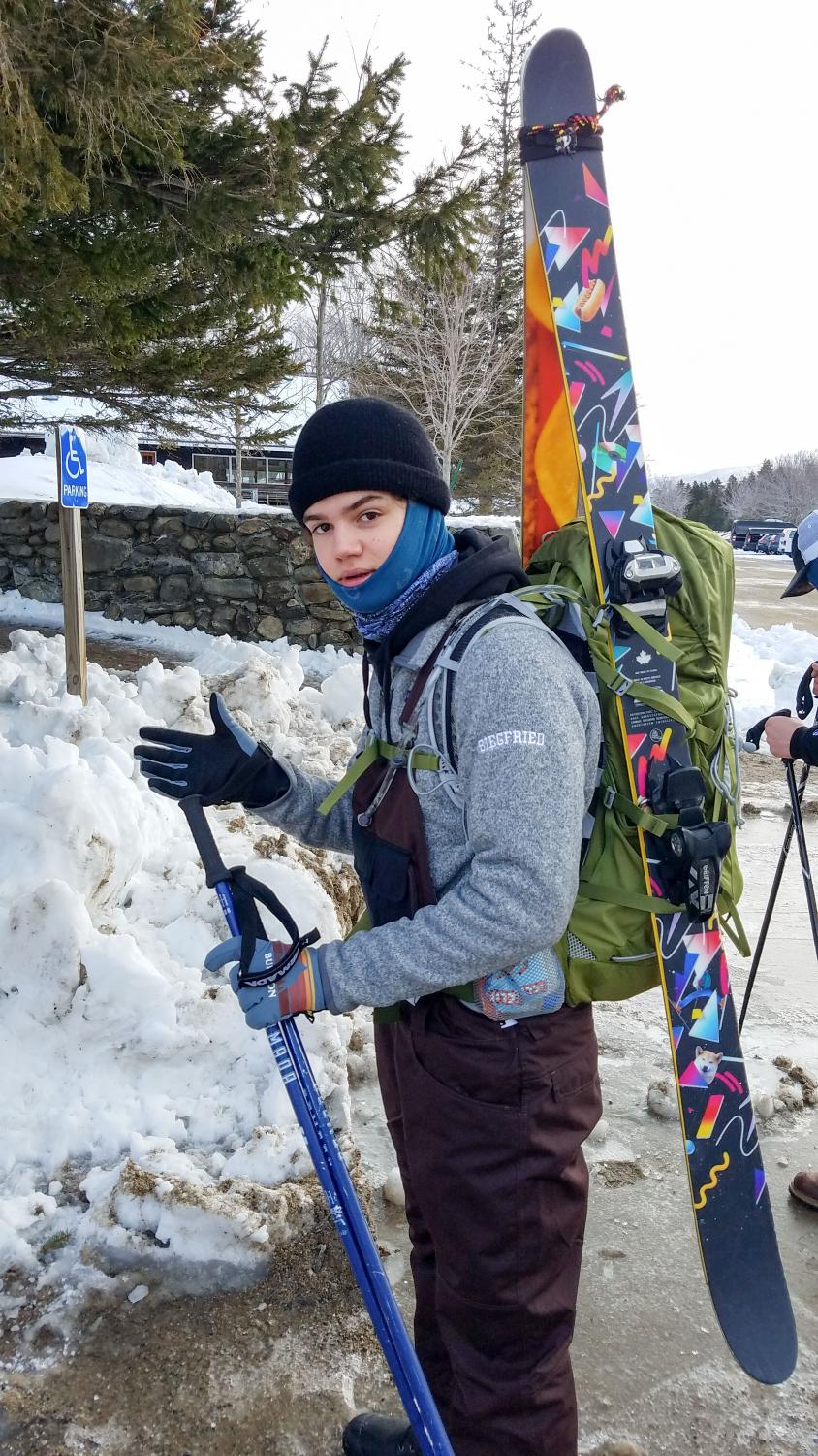
10:24 AM. Max Siegfried getting his gear in order in the parking lot of the Pinkham Notch Visitor Center.
Mark Sanborn, a wellness teacher at Hopkinton High School, climbed and skied Tuckerman Ravine in 2017 with a friend.
“Having a nice efficient bag where everything is tight and it’s not affecting your ability to hike is really important,” Sanborn said.
Most of our packs had hip straps, helping take the load off of our shoulders and on to our hips. This helped lower our center of mass and made the hike much easier.
Something we overlooked was crampons, spikes that attach to your boots. The light dusting of snow on top of a sheet of ice on the trail made it hard to gain traction and resulted in our boots constantly slipping backward.
“I was preparing to just hike up on a wooded, dirt covered trail, but instead we were stuck with snow,” Wang said, “That made it a lot harder because our boots were slipping.”
My brother said an ice pick is also a good idea for the ravine itself because of how steep it is.
We also brought first aids kits, walkie-talkies, and other miscellaneous equipment.
Food
I meticulously planned my food. I brought foods that were high in protein and that would not spoil. I packed two cold-cut sandwiches, celery, carrots, pre-packaged tuna and salmon, protein bars, trail mix, and two liters of water.
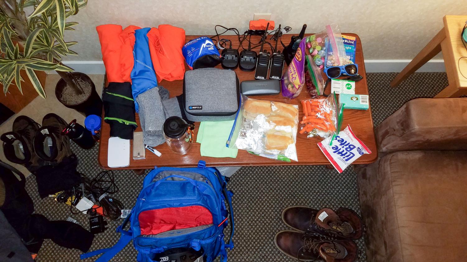
Everything I brought in my pack laid out.
“We went to Hannaford the night before and we got plenty of cold cuts, turkey, swiss cheese, and then I made two sandwiches,” Pomeroy said, “I got peanut butter crackers, nuts, and Clif bars. I brought all that in my backpack and I probably ate most of it at lunch.”
“The key is to pack as light as possible and as efficiently as possible. So any food that’s high in protein, high in nutrition, and that’s very small,” my brother said.
Sanborn said he and his friend each packed a couple of peanut butter and jelly sandwiches with bananas in them, along with Clif bars, NutriGrain bars, and a lot of water.
Clothing
For clothing, I wore Under Armor leggings with snow pants over top, a polyester shirt, and a turtleneck. In my pack, I had an extra pair of socks, three extra polyester shirts, and my winter jacket strapped on the outside of my pack.
“Similar concept as food, you want highly efficient, lightweight clothing. More light layers are better than a couple of heavy layers,” my brother said.
The weather from the bottom of the trail to the ravine can change rapidly, hence more light layers than heavy layers.
“For my first time, I over packed and I brought an extra set of sweatpants which was pretty much pointless,” my brother said.
“When you get going, you sweat a lot and you use a lot of energy,” Sanborn said.
Risk Factor
Because of the steep grade, there are frequent avalanches, this is the main reason why most people, including us, attempt to go in mid to late April. During the warmer springtime, the snowpack is wetter, more slushy, and less prone to triggering.
“Very dangerous,” my brother said.
Once the avalanche danger subsides, you are then looking at the danger of crevasses that begin to open up.
“It’s probably in the start, right around now or within a couple of weeks, or once the snowpack starts to fall off the main headwall, you can see a waterfall that comes over the main headwall and falls into a crevasse and if you slip up and get caught into that crevasse you’re
guaranteed to die because you’re falling underneath the snowpack and getting rushed down into the internal aquifer,” my brother said.
When my brother went, his friend had a slip up while snowboarding down the ravine. His friend lost his footing, landed on his butt, but because of how steep the ravine is, he wasn’t able to regain an edge.
“As soon as he lost his footing, he wasn’t able to dig his snowboard back in and he just kept going faster and faster. Luckily he was able to stop before the rock,” my brother said, “if he had gone over the rock he would’ve fallen off probably a thirty-foot cliff.”
The Hike
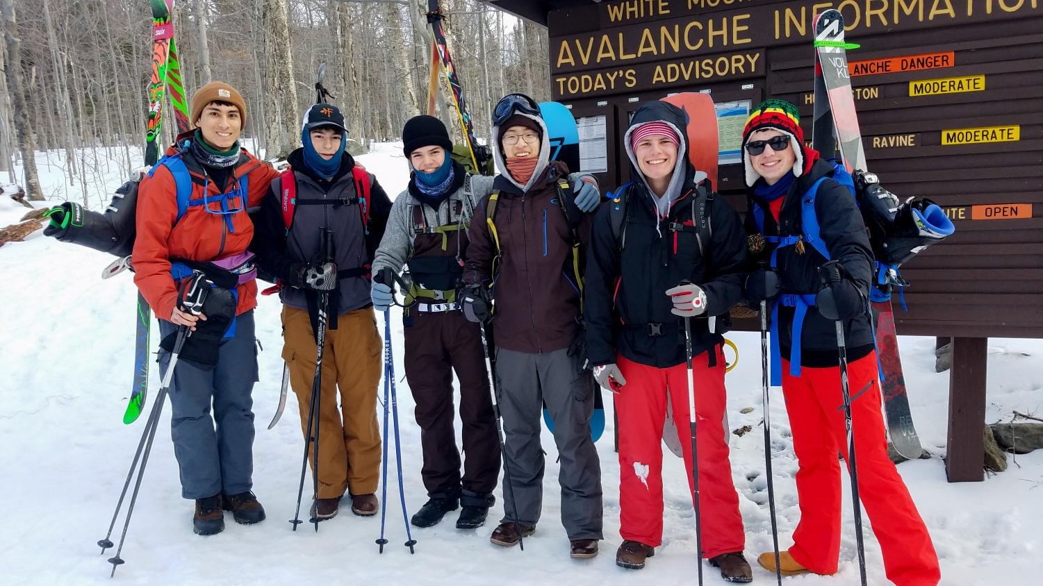
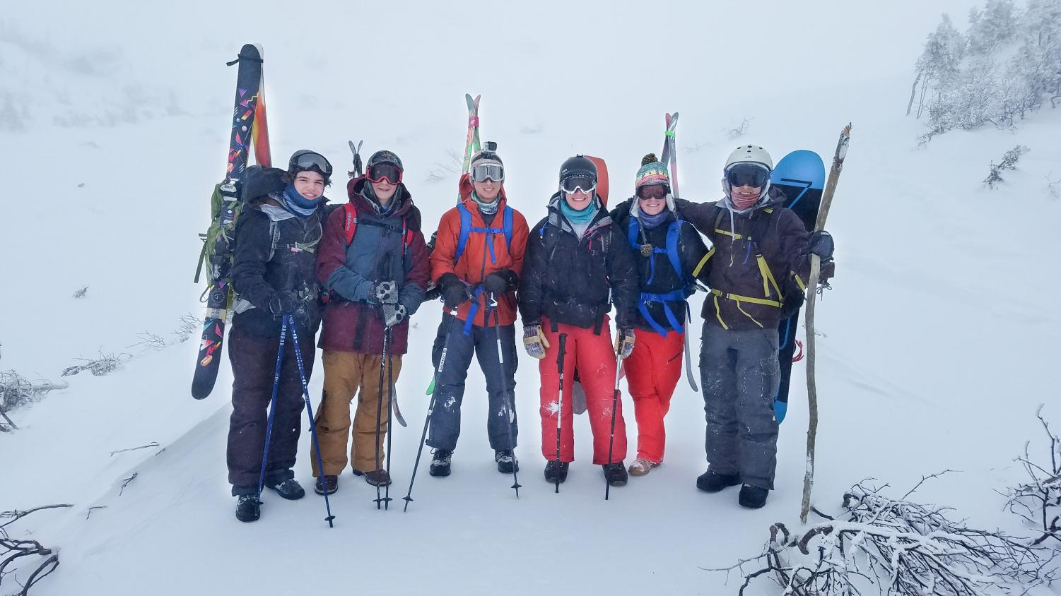
10:35 AM. Us chaps at the trailhead of the Tuckerman Ravine Trail, mentally preparing for the trek.
We left Hopkinton in the afternoon of Tuesday, April 17th, the day after the Boston Marathon, and drove three hours to North Conway, a town twenty minutes from the trailhead of the Tuckerman Ravine Trail.
We took the evening to rest up for the long hike the next day, playing some Wii, relaxing the muscles in the hot tub, and getting some rest.
We woke up the next morning at 7:00 AM, ate a hearty breakfast of eggs and cereal, and then left for Pinkham Notch Lodge (the lodge at the trailhead) at 8:30 AM.
At ten o’clock, after exploring the base lodge, checking the weather, strapping our ski gear to our packs, we began hiking up the Tuckerman Ravine Trail.
At first, we took frequent breaks as some of us realized the difficulty of the hike.
“About a hundred yards in we had to take a break because people were getting too hot so we had to shed some layers,” Pomeroy said, “And then that continued for maybe the first mile; we took frequent breaks because we were all really tired and this was proving to be much harder than we all thought.”
Eventually, we reached a steady pace. After four and a half hours and 2.2 miles of hiking, we made it to Hermit Lake Shelters, an area just below the Tuckerman Ravine bowl with numerous shelters that hikers can lodge in along with a main lodge. It was now 2:00 PM. There, we ate lunch and then decided to continue on to the actual bowl of the ravine, another half mile hike. As we got higher and closer to the bowl the conditions got worse.
“At this point the trails weren’t that clearly marked so we chose a path and hoped it was the right one,” Pomeroy said, “Luckily we ran into a French Canadian man, maybe he was just French, and we entrusted him to bring us to the base of the bowl of the ravine. And as far as I know, that’s what he did.”
The grade of the trail was getting steeper and the snowfall along with the ice on the trail made the hike slippery.
Beyond the Hermit Lake Shelters, it was only us six and the “French guy.” Normally, there are hundreds of people climbing to Tuckerman, but the conditions on that day deterred mostly everybody, and for good reason.
At this point, visibility was around 25 feet, wind speeds were around 60 plus miles per hour, and the wind chill was 5 to -5 degrees Fahrenheit.
“Pretty much blizzard conditions at the top,” Wang said, “We couldn’t even tell we were in the bowl. The only reason we knew that we were in the bowl was because the French guy told us that this was the base of the ravine.”
Sanborn said that when he went, there were people constantly funneling in and out of the ravine throughout the day.
“Going up was busy, getting to the shelter below the ravine was busy, and there were people all up and down the trail,” Sanborn said.
Unfortunately, we were only able to climb to the bowl of the ravine and we were not able to climb or ski the ravine itself because of these hazardous conditions.
Instead, we settled on skiing the Sherburne Trail, the ski trail that takes you from the Hermit Lake Shelters back down to the Pinkham Notch Lodge where we started.
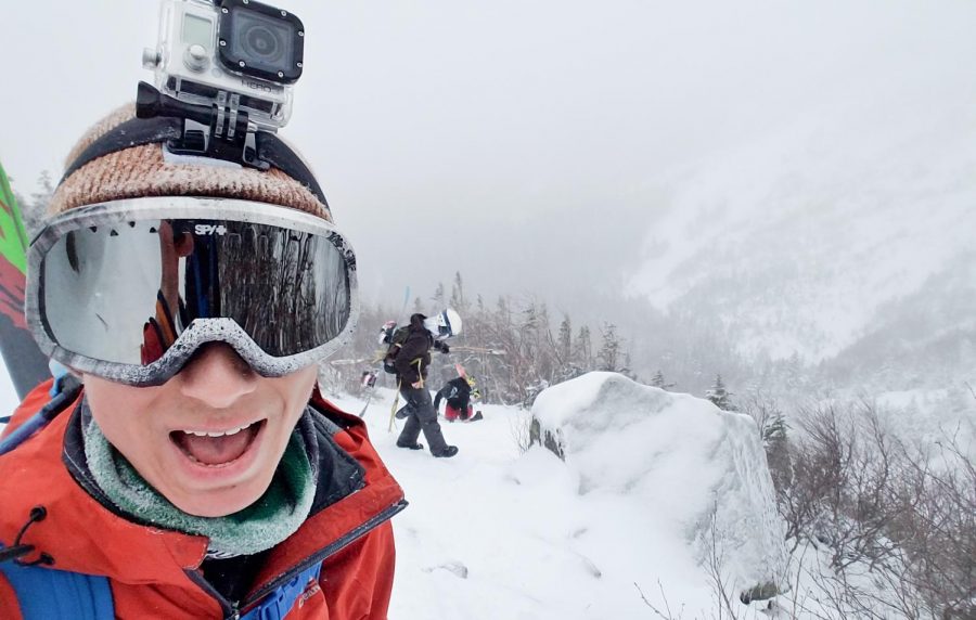
We climbed as far up in the Tuckerman Ravine bowl as we could without entering the avalanche zone. Though we couldn’t really see much, we basked in the experience, took some photos and videos, and then started back down to the Hermit Lake Shelters.
3:31 PM. We have now conquered the world. We made it to the ravine bowl, but any farther and we are in avalanche territory. Unfortunate, but the view was nice (there was no view).
Once there, we stopped into the main Hermit Shelter where there is a gift shop and one employee/caretaker who lives there year round and who looks over the Hermit Lake Shelters.
We popped our skis on and skied down the two-mile long Sherburne Trail, right next to the trail we hiked up.
“On a scale of 1 to 1000, I think hiking Tuckerman Ravine was probably like a 400, maybe 500. Keep in mind that we didn’t actually hike the ravine, we just walked up to the bowl of the ravine,” Pomeroy said.
Hiking up the Tuckerman Ravine trail is not the most difficult thing, but it is a challenge and you do have to be in shape. It is a long, steep, three hour, 2.5-mile hike with varying terrain.
My brother told me that he didn’t do anything different to prepare physically beside his normal exercise.
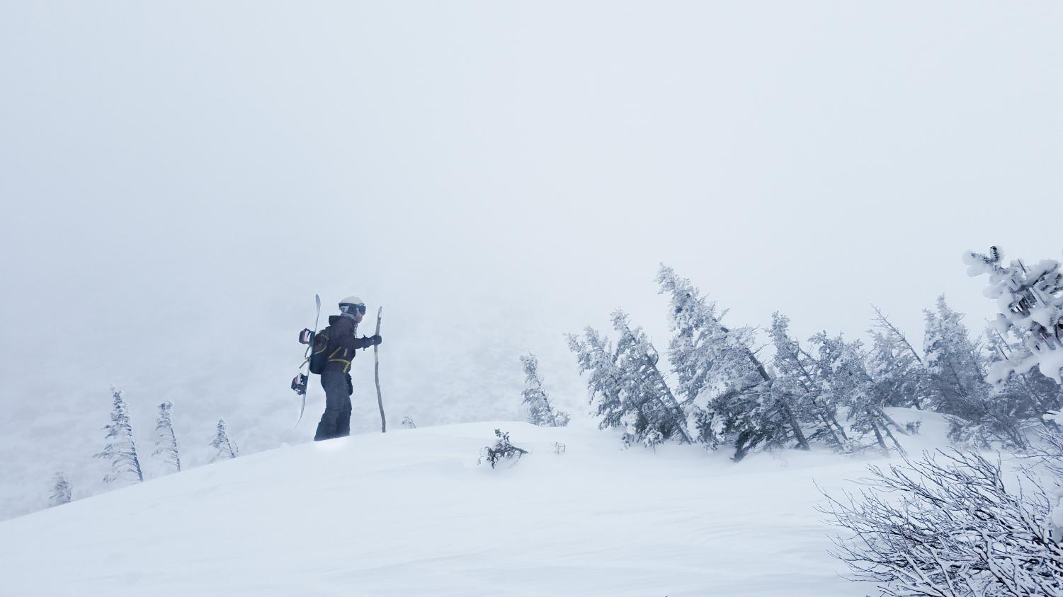
3:25 PM. Lu Wang fighting the howling winds as he makes the final push to the summit of this tiny hill off of the trail.
“You don’t really need to train for it, but you need to be able to move at a pace that’s fast enough so that you can get down before dark,” he said.
Wang said that he also did not do anything different to prepare physically.
“Because I run track normally, that kept me in a relatively good level of fitness for the trip,” Wang said, “We probably should’ve done a bit more preparing, maybe a little bit more cardio, but I think most of the boys were in good enough shape to make the hike up.”
“You just need to be prepared to run out of breath and have sore legs,” my brother said, “because you’re hiking up a mountain of variable terrain with 40 pounds on your back.”
The really hard part comes when you have hiked for three hours and then you have to hike up the ravine itself and ski down it.
“Getting up the face of the ravine was very challenging, I thought the most challenging by far because you’re literally up an inclined slope,” Sanborn said.
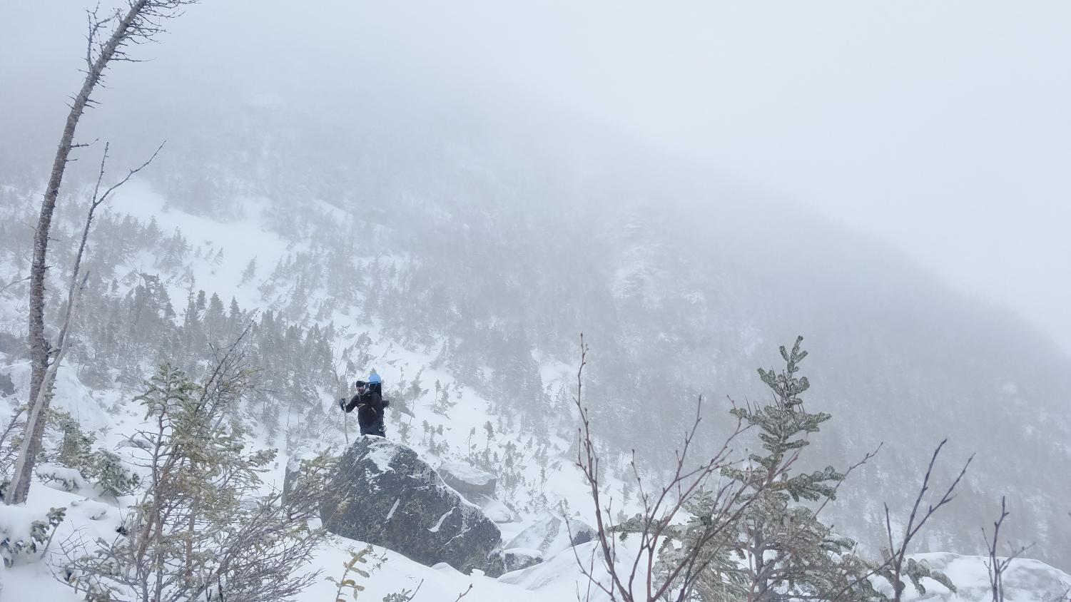
3:45 PM. Lu Wang scaling a rock in the blizzard.
“Really the only difficult part was keeping balance and that would have been helped by having crampons on our boots,” Pomeroy said, “In terms of endurance, it was tiring but I wasn’t ready to collapse at any point during the day.”
On a scale of 1 to 1000, the difficulty for me was around a 688. Like I said previously, it was not the most difficult thing I have ever done, but it was definitely difficult. Again, keep in mind that we only hiked to the ravine and not up it.
“Difficulty was at 300, but realizing how humbling it is and how much respect you need to have for mother nature is 1000,” Antaki said, “It wasn’t that difficult because it wasn’t really too technical, it was just steep and enduring.”
Wang said the difficulty for him was a 575 out of 1,000.
“It wasn’t impossible. It was just walking. It wasn’t any climbing that we actually had to do,” Wang said.
Sanborn said the difficulty for him was an 8 or 9 out of 10.
“I’ve only done it once, and it was challenging,” Sanborn said, “It’s difficult, but that’s why you do it, you like the challenge. The reward at the end is the best part: being able to ski all the way down almost to the parking lot,” Sanborn said.
While we didn’t get to ski the ravine, we did ski the Sherburne Trail as well as Jay Peak the following day. It was a great trip that has us all looking forward to going again.
“It was fun. It was like three hours on the trail with the guys just talking, taking breaks, and taking it at our own pace,” Wang said, “I would definitely go again if I have the chance to.”

The highlighted red is the weather data from the day we went.